De-icing
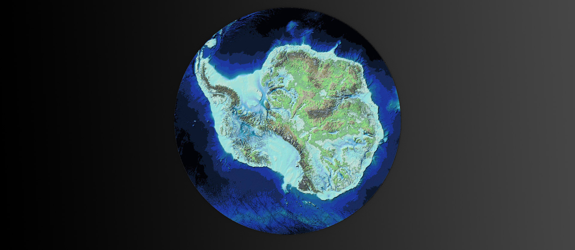
 he most detailed map of the landscape under the Antarctic ice sheet to date was created by a team of international scientists led by the British Antarctic Survey (BAS) and with the participation of the Alfred Wegener Institute. The map, called “Bedmap3”, covers more than six decades of survey data and imagery collected by aircraft, satellites, ships and dogsleds.
Bedmap3 gives us an unobstructed view of the white continent as if its 27 million cubic kilometers of ice had been removed. It reveals hidden places, the highest mountains and deepest canyons. The new data shows that the Antarctic ice sheet is thicker than previously thought and has a greater volume of ice resting on a bed of rock below sea level. This is particularly important at the edge of the continent, where the ice is in contact with the ocean. This increases the risk of more ice melting due to the intrusion of warmer ocean water.
Welcome to Photonworld – a platform for knowledge, interesting facts and science on the topic of light. Photonworld aims to provide a basic understanding of the physics of light and its countless phenomena. From medicine, to art and physics: all topics are covered.
Photonworld originated as an initiative of the excellence cluster the Munich-Centre for Advanced Photonics (MAP) and the Laboratory for Attosecond Physics (LAP) at the Max Planck Institute of Quantum Optics (MPQ).


The initiator of the project is Prof. Dr. Ferenc Krausz, Chair of Experimental Physics at the LMU and Director of the MPQ.
Photonworld’s Student Zone reports directly out of the PhotonLab, which is supported by the Munich Center for Quantum Science and Technology (MCQST) and the DFG Research Unit FOR 2783. At the PhotonLab, schoolteachers and students can find up-to-date information about experiments and goings-on at the lab, and plan their own visit to the laboratory.